


We See What Others Cannot
Soar is an online atlas with a huge number of maps, satellite and aerial photos of the world, sounding data. Including historical maps, climatic, agricultural, geological, transport, marine, environmental changes, reliefs. Literally, cards for all occasions. Show my street,DualMaps – tools for working with Google maps. The second one contains three maps linked to: 2-D,…
Read More “Maps, satellite images and video broadcasts around the world” »
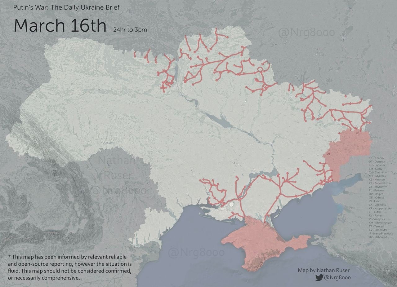
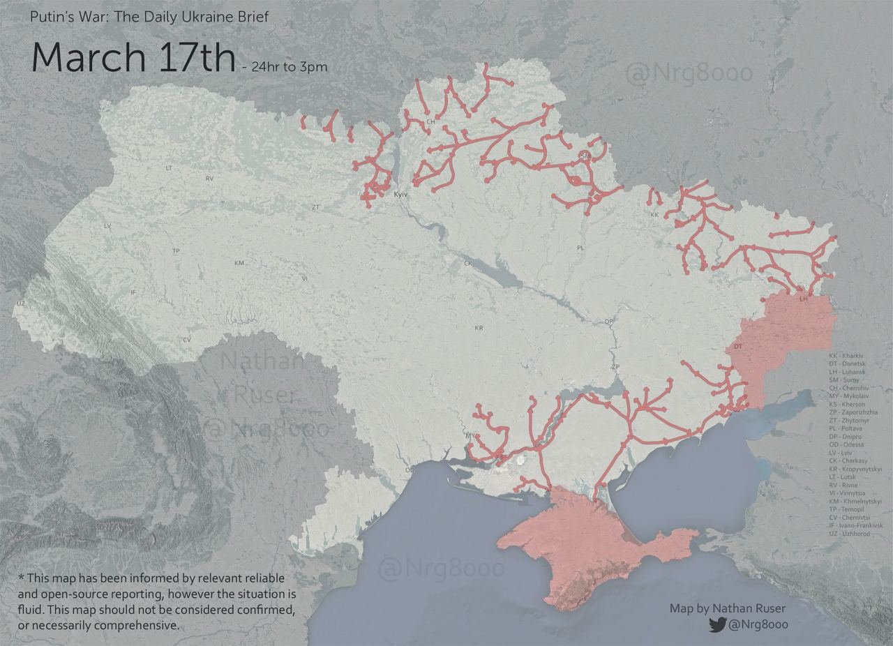
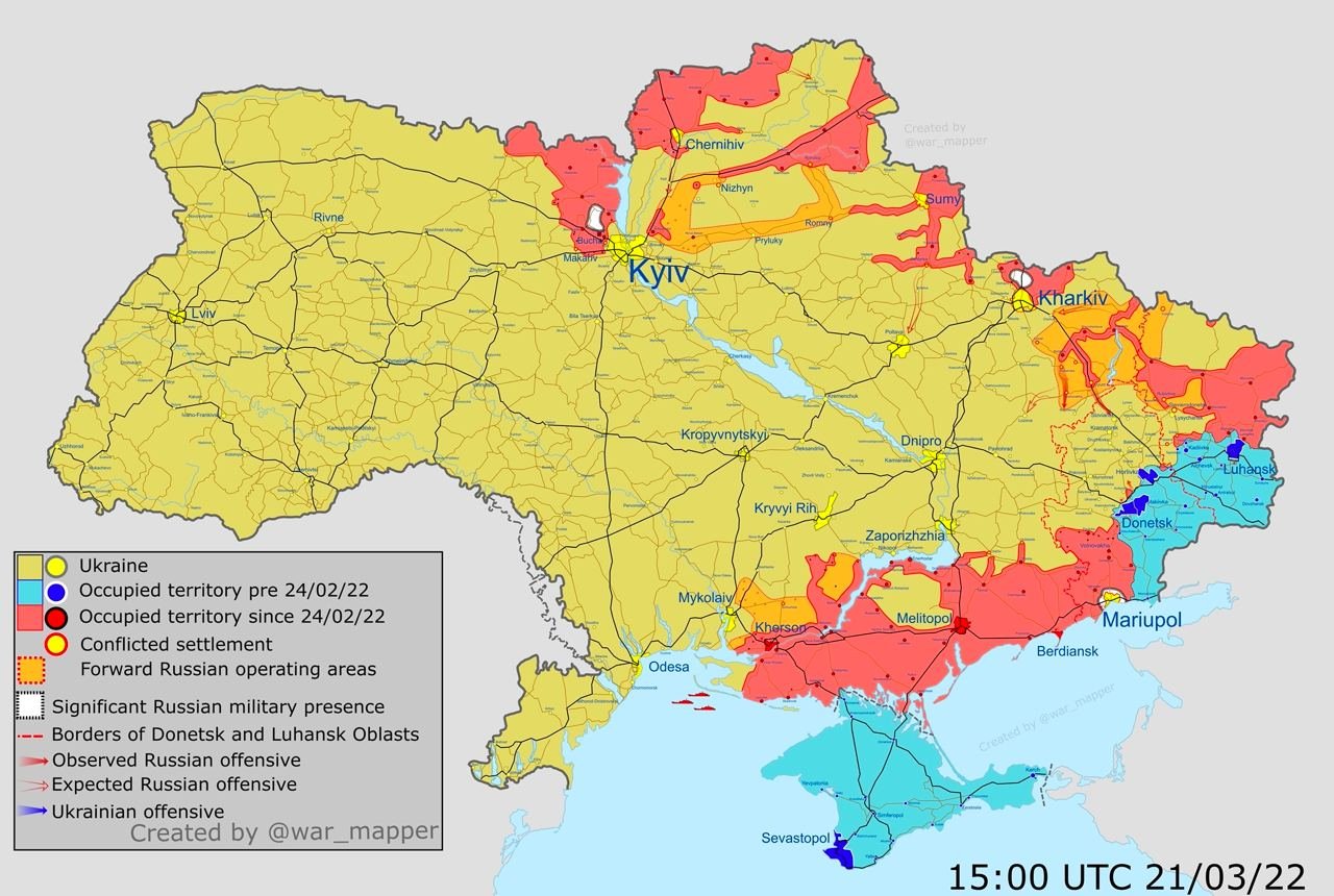
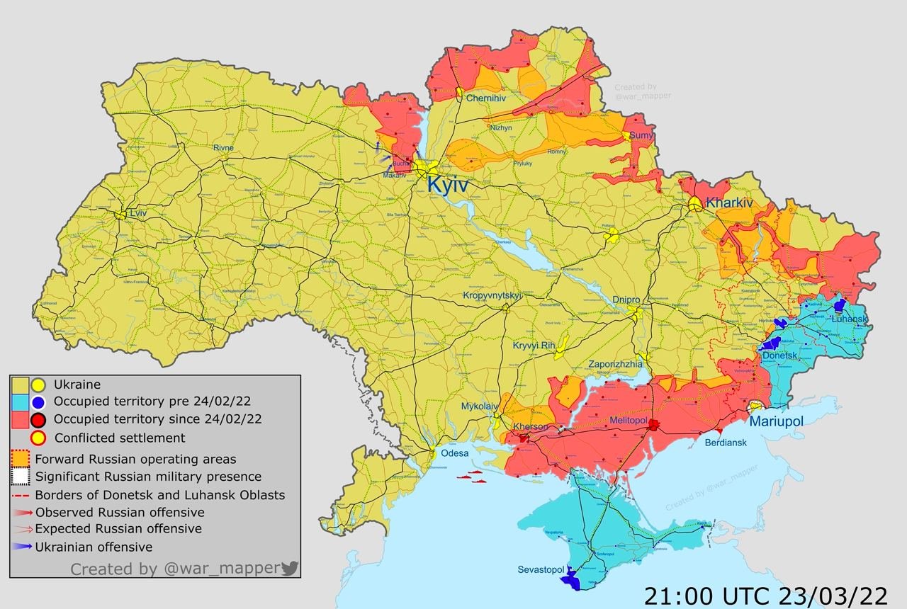
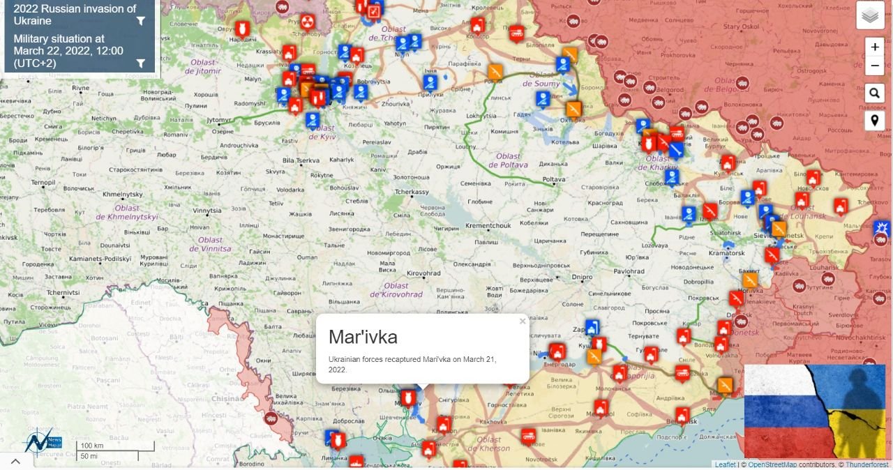
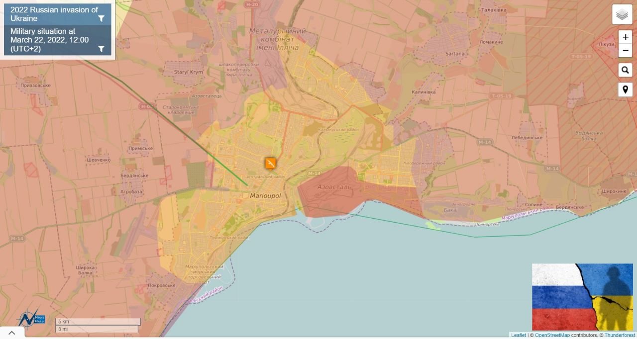
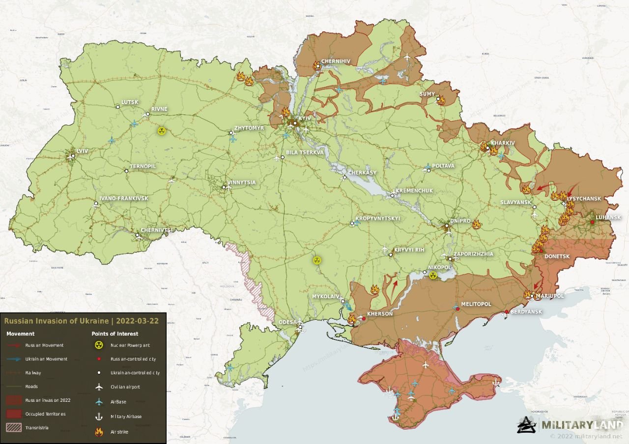
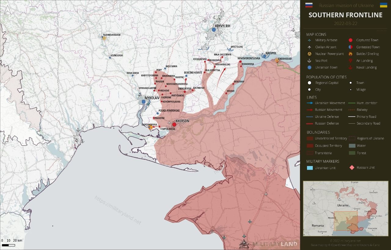
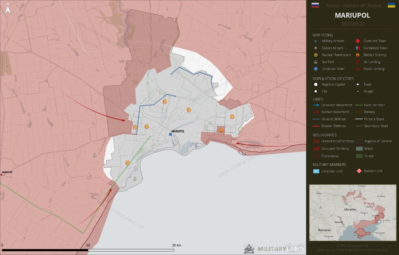
In OSINT you have to work with coordinates, GPS data and maps to determine the location of a particular object. An article from Leakinfo with a selection and brief overview of relevant and useful Internet resources that can make working with maps easier.
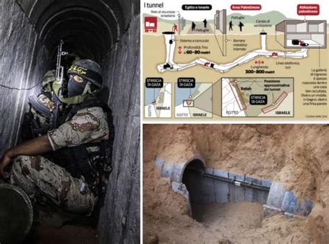
deepest tunnel discovered by the IDF so far was at a depth of 70 meters – almost as deep as the Channel Tunnel. ЦАХАЛ опубликовал новые кадры наземной операции в секторе Газа, на которых видно, как бронетехника и солдаты передвигаются по территории анклава. А со стороны ХАМАС появились фото туннелей. Как видно, достаточно широкие для…
Read More “Gaza Tunnels Pictures, Depths, Hive, and Maps, Locations,” »

Now in Google Maps, images of all Russian military installations are available in maximum resolution. On the picture: 1. Air base near Kursk.2. Launching position of an intercontinental ballistic missile;3. Fighter 5-generation Su-57 in the flight test center of the Ministry of Defense of the Russian Federation;4. Base for storage of nuclear weapons near Murmansk;5….
Read More “Google stopped hiding Russian secret objects on its maps” »


You must be logged in to post a comment.